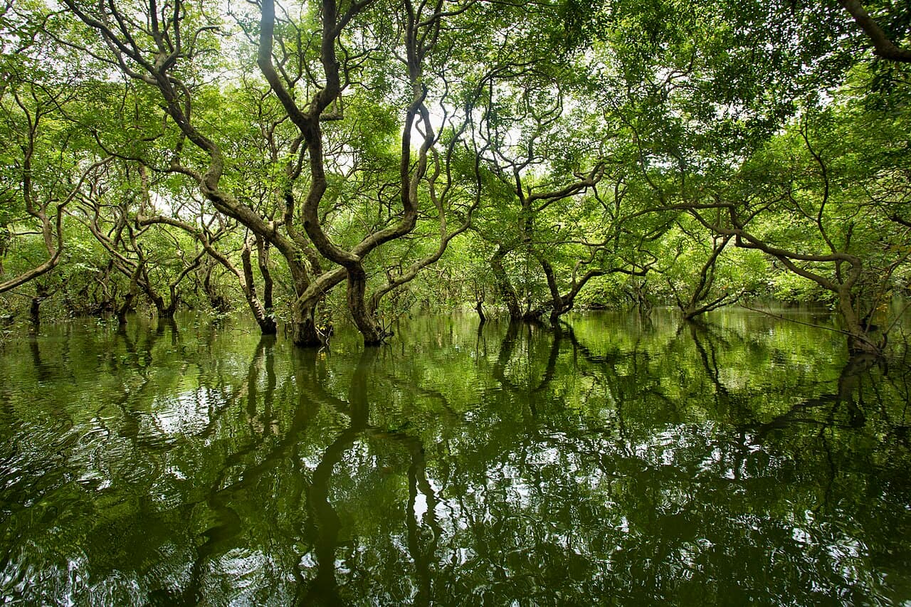
Ratargul is often reduced to a seasonal before-and-after image: trees surrounded by water or a forest floor exposed. A calendar cannot tell you today's water level, flood risk, boat access or local restriction. The Tourism Board identifies Ratargul as a freshwater swamp forest, while the Forest Department provides protected-area context and the Flood Forecasting and Warning Centre supplies live decision tools. A responsible plan combines those sources with current local confirmation and never treats flooding as a spectacle to enter.
At a glance
Start here
- Use live FFWC and BMD information, not a guaranteed season label.
- Confirm the actual access point, authorized boat arrangement and local restrictions.
- Treat high water and flood danger as different questions.
- Keep a dry-land alternative in the Sylhet area.
01
Replace the season question with a conditions question
The Tourism Board identifies Ratargul as a freshwater swamp forest connected to the Gowain River area in Gowainghat, Sylhet. That landscape naturally changes with water conditions, but the destination page cannot establish the level on your travel date. Asking for the best month invites a false guarantee. Ask instead: what are the current level, forecast, access status and local instructions for the exact day?
This shift protects against two opposite errors. Low water may mean the scene differs from an image of flooded trees, but it does not make the forest meaningless. High water may create the expected view, but it can also accompany dangerous regional flooding. Neither appearance should be treated as a safety verdict. Use official live information and a responsible local confirmation before choosing whether to go.
- Ask about current level, forecast, access and restrictions.
- Do not equate high water with a better or safer visit.
- Accept that the forest's appearance can differ from marketing photographs.
02
Use a source ladder before arranging transport
Begin with the Flood Forecasting and Warning Centre's current forecast and data services, then review Bangladesh Meteorological Department forecasts and warnings. These national tools describe water and weather context. Next, ask a responsible accommodation or operator about the exact approach road, jetty, local closure and boat operation. Finally, obey forest staff, local administration and emergency instructions on arrival.
Each rung answers a different question. FFWC data does not book a boat; an operator's message does not replace a flood warning; a destination page does not certify current access. Record when each check was made because conditions can change between booking and departure. If the sources conflict, choose the more cautious interpretation and seek clarification from the competent authority rather than averaging the answers.
- FFWC: current flood and water-context check.
- BMD: weather and warning check.
- Local authority or responsible operator: exact access and operation check.
03
Confirm the whole access chain
A Ratargul plan is more than reaching a pin on a map. Confirm the pickup identity, exact destination-side access point, whether a boat is currently operating under local rules, who is responsible for the boat and how the return is arranged. Ask whether recent water has affected the road or landing. Do not accept an offer that relies on changing vehicles or boats without naming the handoff and responsibility.
Boat availability is not itself evidence that conditions are appropriate. Look for the capacity and safety instructions given by the responsible operator, keep the group within those limits and follow any requirement for flotation equipment. This guide does not certify a provider or define equipment standards; current local authorities and competent operators must do that. If the craft appears overloaded, damaged or inconsistent with the confirmed arrangement, do not board.
- Name the pickup, access point, boat responsibility and return plan.
- Ask how recent water has affected both road and landing.
- Decline an overloaded, damaged or unexplained replacement craft.
04
Read a swamp forest without forcing one image
The Tourism Board and Forest Department identify Ratargul within Bangladesh's swamp-forest and protected-area context. At higher water, reflections, trunks and boat movement may dominate attention. At lower water, ground form, roots, channels and the relationship between forest and adjoining land may be more visible. Both can support observation if access is authorized and conditions are suitable.
Keep voices low, leave plants and wildlife undisturbed, carry all waste out and avoid directing a boat into vegetation for a closer photograph. Do not feed animals or treat a quiet forest as an invitation for amplified music. These are editorial low-impact standards consistent with protected-area care; current site rules control. Ask a qualified guide to distinguish a species identification or ecological explanation from a guess.
- Let current water reveal different parts of the landscape.
- Do not push a boat into vegetation for an image.
- Keep ecological claims attributed to qualified interpretation.
05
Distinguish expected inundation from flood danger
A swamp forest can be inundated as part of its changing character, while a regional flood warning concerns risk to people, roads, settlements and movement. Those facts can coexist. GOV.UK currently reports that flash floods and landslides have affected Sylhet, alongside the continuing seasonal flood risk, and points travellers to Bangladeshi forecasting authorities. Water around trees is never enough evidence that the road journey or boat outing is appropriate.
Review FFWC information for the relevant rivers and region, then ask what local authorities are advising. Avoid travel into flooded roads, rescue activity or restricted zones for the sake of seeing dramatic water. If a warning escalates after arrival, prioritize leaving or sheltering as instructed, not completing the forest visit. Advice from your own government and insurer also matters because foreign advisories are nationality-specific.
- Treat landscape water and hazardous flooding as separate judgments.
- Never enter a warning or response area for dramatic photographs.
- Follow evacuation, closure or shelter instructions immediately.
06
Build a two-outcome day
Plan one outcome in which current information supports the Ratargul visit and another in which it does not. The first still requires verified access, a responsible boat arrangement and a return check. The second should use a lawful, confirmed dry-land activity or simply a slower day in the established base. Do not make the alternative another water-dependent place affected by the same regional conditions.
Tell everyone in the group before departure that cancellation is a successful use of the plan, not a failure. This removes pressure from a driver or boat operator to continue when information changes. Keep any nonrefundable cost small enough that it does not distort judgment, and ask for cancellation terms before paying. These are editorial planning suggestions; official forecasts and local instructions remain the facts that trigger the decision.
- Prepare a Ratargul outcome and a genuinely dry alternative.
- Agree in advance that a warning or closure ends the attempt.
- Understand cancellation terms before money creates pressure.
07
Repeat the checks at the right moments
Check official forecasts when considering the trip, again before committing to transport and again shortly before departure. Ask the local contact for a time-stamped update on the access road and operation, not simply a recycled photograph. On arrival, current signs and staff directions overrule the remote plan. The exact frequency should respond to changing conditions rather than a fixed schedule in this article.
Keep the FFWC and BMD pages saved, along with the operator, accommodation and emergency contacts. Share the broad route with a trusted person. If phone coverage or communication is uncertain, establish the return and missed-contact plan before leaving the base. No combination of checks makes the outing risk-free, but repeated decision points prevent an old assumption from controlling a dynamic wetland day.
- Time-stamp local updates and reject recycled images as proof.
- Let on-site authority instructions overrule the booking plan.
- Set return and missed-contact arrangements before entering the access chain.
Useful answers
Reader questions
What is the best month to see Ratargul flooded?
No month can guarantee a particular level or safe access. The Tourism Board establishes Ratargul's swamp-forest identity, but current conditions require live FFWC and BMD information plus local confirmation. Ask about today's water level, forecast, road, landing, boat operation and restrictions instead of treating a season label as a promise.
Sources: Bangladesh Tourism Board; Flood Forecasting and Warning Centre, Bangladesh Water Development Board; Bangladesh Meteorological DepartmentDoes high water mean it is a good day to visit?
No. High water can coincide with dangerous flooding that affects roads and communities. GOV.UK currently reports that flash floods and landslides have affected Sylhet, beyond the seasonal risk. Use official forecasts and local instructions, and never enter a warning, closure or emergency-response area to see dramatic water.
Sources: Flood Forecasting and Warning Centre, Bangladesh Water Development Board; Flood Forecasting and Warning Centre, Bangladesh Water Development Board; UK Foreign, Commonwealth & Development OfficeHow should I choose a boat?
Confirm the responsible operator, authorized access point, capacity, safety instructions, return arrangement and current local permission before boarding. Availability is not proof of suitability. Do not board an overloaded, damaged or unexplained substitute craft. This guide does not certify providers; competent local authorities and current operators must define the applicable requirements.
Sources: Bangladesh Tourism Board; Bangladesh Forest Department; Flood Forecasting and Warning Centre, Bangladesh Water Development BoardWhat should I do if conditions change after booking?
Repeat FFWC, BMD and local access checks and let the newest competent instruction control. Postpone or use a dry-land alternative if a warning, closure, damaged approach or unclear boat arrangement develops. Ask about cancellation terms before payment so sunk cost does not push the group into a poor decision.
Sources: Flood Forecasting and Warning Centre, Bangladesh Water Development Board; Bangladesh Meteorological Department; UK Foreign, Commonwealth & Development OfficeRead the evidence
Sources and further reading
These sources support the relevant sections above. Plans and comparisons are editorial suggestions. Check operators for current arrangements.
- Ratargul Swamp Forest ↗Bangladesh Tourism Board · Accessed 14 September 2026
Official destination identity and location of Ratargul as a freshwater swamp forest in the Gowainghat and Gowain River area.
- ভূমিকা ↗Bangladesh Forest Department · Accessed 14 September 2026
Official protected-area context identifying Ratargul within Bangladesh's swamp-forest conservation landscape.
- FFWC API Service - Bangladesh Water Development Board ↗Flood Forecasting and Warning Centre, Bangladesh Water Development Board · Accessed 14 September 2026
Official live water and flood data service used to emphasize current conditions rather than a seasonal guarantee.
- Flood Forecasting & Warning Centre, BWDB, Bangladesh ↗Flood Forecasting and Warning Centre, Bangladesh Water Development Board · Accessed 14 September 2026
Official current flood-forecast decision tool used before road and wetland access decisions.
- Bangladesh Meteorological Department (BMD) ↗Bangladesh Meteorological Department · Accessed 14 September 2026
Official current weather forecasts and warnings for the regional conditions check.
- Bangladesh travel advice ↗UK Foreign, Commonwealth & Development Office · Accessed 14 September 2026
Current report that flash floods and landslides have affected Sylhet, plus seasonal flood risk and direction toward Bangladeshi forecasting services; nationality-specific caveat retained.